The Maplewood Map
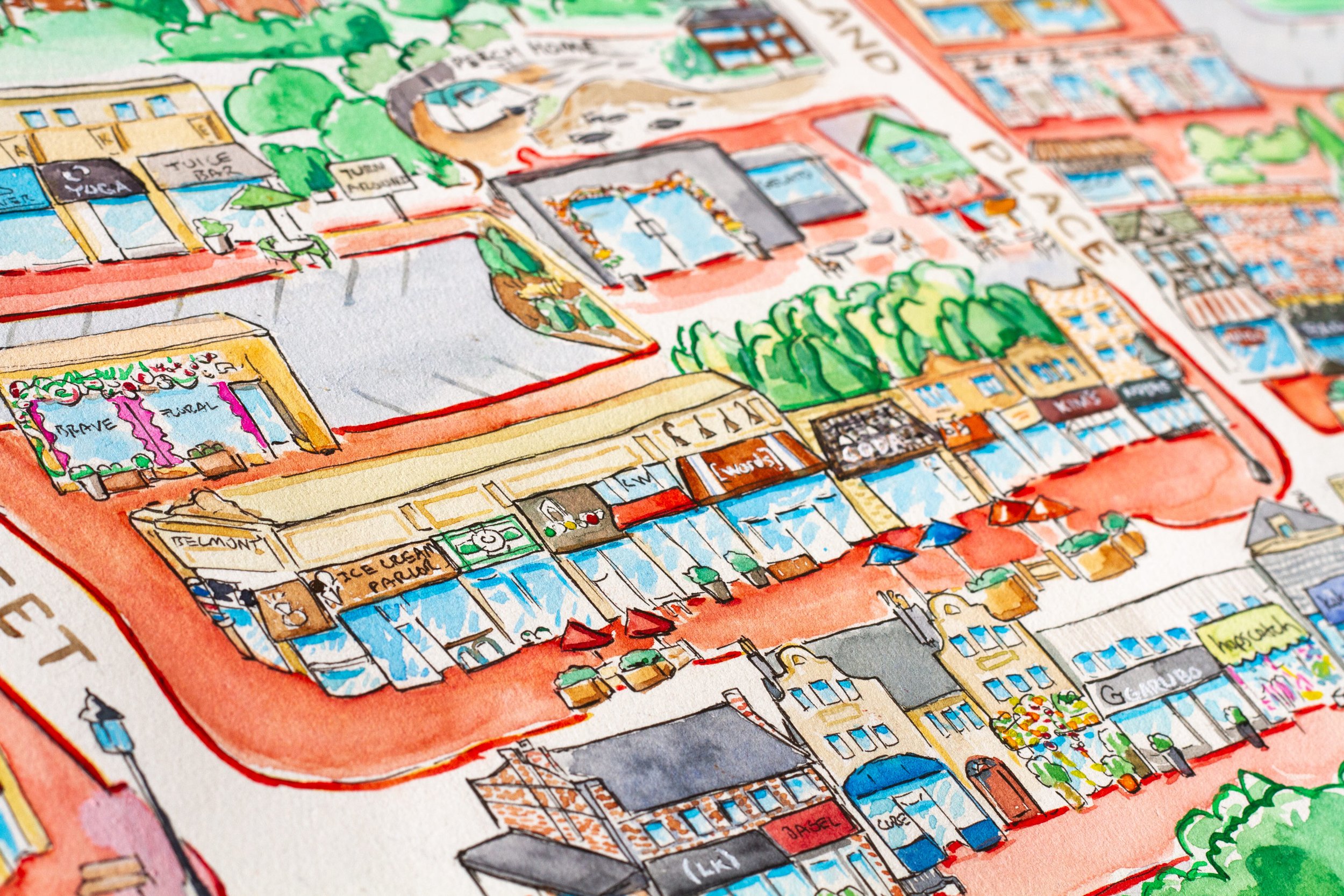
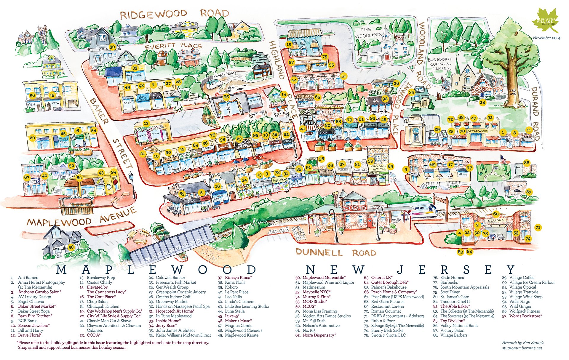
Oh man, i don’t even know where to start with this project. After illustrating the insides & outsides of dozens of local shops, ErinRose Baldry from the Maplewood Village Alliance reached out and asked if I could do a map of all of downtown Maplewood’s businesses. Obviously, I leapt at this opportunity.
I hadn’t ever done anything like this before! And I love the illustrated maps that you see of other towns, cities, etc. I fired up my hardly-used pinterest account just to get some inspiration on how other illustrators have tackled such a job. This was a huge challenge! It’s easily the largest, most complicated thing I’ve ever worked on. On top of this illustration, there will be a printed version in Matters Magazine with all of the shops numbered and labeled.
Let me tell you… that part was bananas. But I persisted! On top of that, it gave ErinRose an opportunity to do a thorough audit of all of the active businesses downtown. It had been years since a full list was built, and now it’s very solid. Go team.
I met ErinRose at Jerry Rose floral (no relation), when she was being brought around to all the local shops by Amy Howlett. I was in Jerry Rose to promote my book when i was kickstarting it. Meeting ErinRose was justa. a happy accident of schmoozing. We kept in touch, and months later she reached out with this idea of a map for Matters Magazine. To give full credit, Mika from A Paper Hat may have planted that seed years ago. She had floated this idea to me in the past, and it’s always been percolating on a back burner of mine. Now it is growing into a real life thing!
I started by doodling a little bit downtown one day just as a proof-of-concept to see if this was even feasible. It was a loose, rough sketch. I needed to know what happened when I drew these facades at 1/100 scale and tried to draw them all together at the scale of the paper I was using! After about half an hour i was convinced that it was doable. (Obviously everything is doable, but I hadn’t done anything like this before). Next, I had to bend space and time to my will to make it all work.
OK that’s an exaggeration. I didn’t really have to bend time. But I did have to bend space - turning buildings around to face the opposite direction so they’d be visible in the composition. Why was this so challenging? Because all the buildings on one side of Maplewood Ave are in reverse order.
What does that mean? If you’re looking at Osteria LK, the bagel chateau is to it’s left. In my illustration, it’s to the right. Positionally, it’s further up the street - which is correct - but I’m more of a representational artist. I draw what I see more often than I imagine what to draw. This got me WELL outside of my comfort zone.
The corner where Osteria LK is was the absolute trickiest, because I had to turn the building inside out in my head to make it work. It hurt. It hurt my brain.
Then I had to realize that I needed to break some buildings apart. That’s the only way it was going to work. A lot of the shops up Baker street are in long buildings, all connected together. Again, I couldn’t face them towards baker Street, because then you wouldn’t really be able to see the storefronts. At one point I realized “Oh wait a second. I’m creative” and remembered that I can make my own rules and even break all my rules. So Brave Floral, Toy Division, City W, Baker Street Market - all of those SHOULD be attached to other buildings but they’re not. Because I had to make it work somehow. And it works!
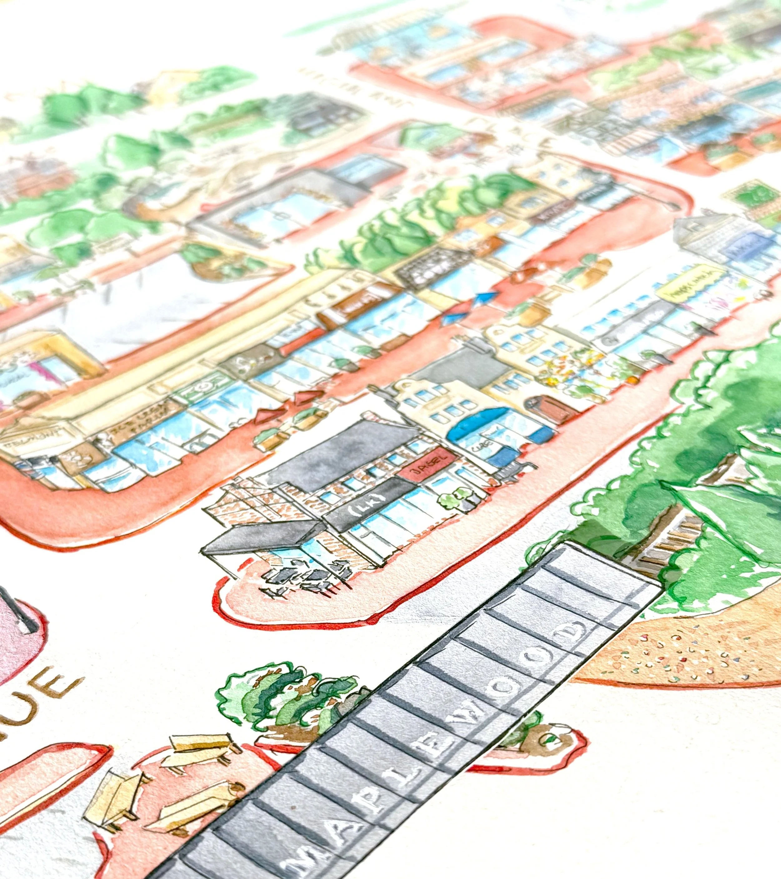
Then I forgot to make the train bridge. This is obviously an iconic part of maplewood, and 100% needed to be in the map. I had already drawn that little patch of landscaping underneath it though. Oh no! What was I going to do?!? Again, I can make & break rules - so I drew the bridge on another piece of paper, cut it out, and stuck it on. I actually drew that bridge three times before I had one that I liked. I sure hope someone notices the gum wall underneath the train bridge. That’s my other favorite part.
No such luck with the whole map though! No starting over with as huge a project as this! At one point I almost abandoned it because I thought I hated where it was going. I did a bunch of quick, frustrated pen drawing one late evening expecting to start over the next day, but the next day I looked at it and I loved it again and kept on keeping on.
I spent every day of the week over about two weeks perching in spots downtown, drawing for 10 minutes then moving up the street to draw some more. There’s a real strong chance you saw me out there. This was so much fun actually. As disturbingly warm as this fall has been, it sure was nice to sit outside & chat with people as they saw me working on this. I got a cupcake out of a friend passing by. I got interviewed by some guys working on a school project (I wish I could find those people & see what they came up with). I found out about this 1910 map from a Alexander Black - a complete stranger - who described it and emailed me this link afterwards. https://www.loc.gov/resource/g3814m.pm005190/?r=-0.043,0.003,1.189,0.76,0


